The Drum · Weekly AI news, freeSubscribe →

Share
As wildfires grow faster and more destructive, engineers are turning to orbiting sensors and machine learning to spot the first wisps of smoke, hours before human eyes or ground crews ever could.
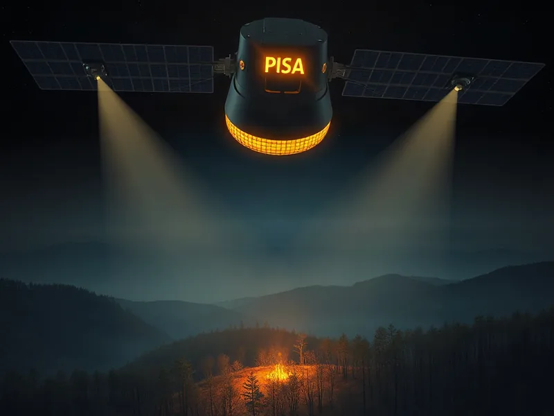
Picture a small ember catching in dry brush on a remote hillside. For hours, maybe longer, nobody notices. By the time smoke is visible from a nearby road, the fire has already claimed acres. That gap between ignition and detection is where lives, homes, and entire ecosystems are lost. It's also the gap that a new generation of AI-equipped satellites is racing to close.
Wildfires have become a defining hazard of the warming climate. Longer droughts, drier vegetation, and hotter summers are turning once-manageable burns into fast-moving infernos that outpace traditional detection methods. Ground-based reports and human observation towers simply cannot keep watch over the vast, often inaccessible terrain where fires now ignite. Satellites can, and increasingly, they're equipped with artificial intelligence trained to recognize the earliest fingerprints of a blaze.
Think of it like the difference between smelling smoke from across a house versus waiting for someone to shout "fire." Traditional satellite monitoring often relies on visible smoke plumes or heat signatures large enough to register on relatively coarse sensors. AI models, by contrast, are trained to catch subtler patterns: shifts in surface temperature, changes in reflected light, small hotspots that haven't yet grown into a visible plume. The technology doesn't wait for the fire to announce itself. It listens for the whisper before the shout.
The core idea is straightforward, even if the engineering behind it is not. Satellites orbiting Earth continuously capture imagery across multiple wavelengths, including infrared bands that can reveal heat invisible to the naked eye. Machine learning models are trained on vast archives of past fire events, learning to distinguish the telltale signs of ignition from ordinary background noise like sun glare, cloud cover, or agricultural burning.
Once trained, these models can process incoming satellite data in near real time, flagging anomalies that suggest a fire has started. That's a meaningful shift from older approaches, which often required human analysts to review imagery manually or wait for onboard sensors to cross a fixed threshold of heat or brightness. Speed matters enormously here. Fire behavior researchers have long noted that the first hour after ignition is often the difference between a controllable brush fire and a catastrophic wildfire event.
This approach also complements, rather than replaces, existing systems. Ground sensors, aerial patrols, and satellite constellations from agencies and private companies alike all feed into a broader detection ecosystem. AI models act as an additional layer of vigilance, one that never sleeps and never blinks, scanning enormous swaths of terrain that would otherwise depend on chance sightings or delayed reports.
There are real limits to what this technology can promise, and they're worth stating plainly. Satellite revisit times, meaning how often a given satellite passes back over the same patch of ground, still constrain how quickly a new fire can be caught on camera. Cloud cover can obscure a hotspot entirely. And AI models are only as good as the data they were trained on, which means unusual fire behavior or unfamiliar terrain could still slip past the algorithm's expectations. No system offers perfect coverage, and any responsible deployment has to be paired with continued investment in ground crews, aerial response, and community preparedness.
There's also a quieter risk worth naming: over-reliance. If communities or agencies come to see AI detection as a silver bullet, funding and attention for traditional firefighting infrastructure could erode. That would be a mistake. The technology is best understood as an early-warning multiplier, not a replacement for the people and equipment that actually put fires out.
Still, the potential upside is substantial. Earlier detection means firefighting resources can be dispatched before a blaze spreads beyond a containable perimeter. It means evacuation orders can go out with more lead time, giving families precious extra minutes to gather belongings, secure pets, and get on the road safely. For utility companies managing power lines in fire-prone regions, faster detection could mean the difference between catching a spark before it becomes the next headline-grabbing disaster and reading about it after the fact.
The economic case is compelling too. Wildfire suppression costs have climbed for years, and insurance losses in fire-prone states have followed a similar trajectory. Catching fires smaller and earlier translates directly into lower suppression costs, fewer destroyed structures, and less strain on emergency response systems that are already stretched thin during peak fire seasons.
The stakes here go well beyond technical achievement. Wildfires displace families, destroy homes, and in the worst cases, cost lives. They also degrade air quality across entire regions, sending smoke hundreds of miles from the original blaze and putting vulnerable populations, including children, the elderly, and people with respiratory conditions, at heightened health risk. Every hour shaved off the detection timeline is an hour that firefighters, evacuation planners, and public health officials get back.
This matters most for the communities that have historically been hardest to protect: rural areas, tribal lands, and regions where wildfire risk has outpaced the resources available to monitor it. AI-powered satellite detection won't fix underlying issues like forest management practices, aging power infrastructure, or the deeper climate trends driving fire risk upward. What it can do is buy time, and in wildfire response, time is often the single most valuable resource there is.
The technology is still evolving, and researchers continue refining these models to reduce false alarms and improve accuracy across diverse landscapes, from dense forests to arid grasslands. But the direction is clear. As climate pressures intensify and fire seasons stretch longer each year, the tools we use to watch for danger need to get smarter, faster, and more far-reaching. Satellites armed with AI are becoming a genuine part of that answer, not a complete solution, but a meaningful step toward catching disaster before it fully takes hold.
Tags
Original Sources
Satellites and AI Team Up for Faster Wildfire Detection
↗ https://spectrum.ieee.org/ai-wildfire-detection
About the author
Amara's entry point into AI was an epidemiology role at a London research hospital, where she spent five years studying how digital health tools reached — or conspicuously failed to reach — underserved communities. Watching early algorithmic systems in healthcare quietly entrench existing inequalities, she redirected her career toward the systemic consequences of AI at scale. She covers AI through an unflinching lens: who benefits, who bears the cost, and what evidence actually says versus what the press release claims. Her writing is calm and precise, but she doesn't mistake balance for neutrality.
More from The Steward →This Week's Edition
9 September 2026
29 articles
Related Articles

xAI Formalizes Its Ecosystem Play With SpaceX Super Intelligence Partner Network
Products & Applications · 5 min

Sentara Health Rolls Out AI Tool to Help Case Managers Move Patients Through Care Faster
Products & Applications · 6 min

Talkiatry Pushes Therapy Nationwide, Betting on Integrated Care to Close Behavioral Health Gaps
Products & Applications · 5 min
Related Articles
xAI Formalizes Its Ecosystem Play With SpaceX Super Intelligence Partner Network
Products & Applications · 5 min
Sentara Health Rolls Out AI Tool to Help Case Managers Move Patients Through Care Faster
Products & Applications · 6 min
Talkiatry Pushes Therapy Nationwide, Betting on Integrated Care to Close Behavioral Health Gaps
Products & Applications · 5 min
More Stories
© 2026 Cedar & Bloom. All rights reserved.